Hike Date: November 12, 2020
Destinations: Sherman Mt, and Good Luck Cliffs
ADK Location: Ferris Lake Wild Forest
Roundtrip Mileage: 8 +/-
Elevation: Sherman (2,641ft), Good Luck (2,151ft.)
Elevation gain: 1,100 ft. combined.
This was my third trip back to the Chub Lake area. In my previous hikes here I had visited Chub Lake Mt. and North Branch Mt. My plan on this day was to do a bushwhack to Sherman Mt., which sits between Chub Lake Mt. and North Branch Mt, and then, if time allowed, to drive over to do a quick climb up to Good Luck Cliffs, my third visit there this year, and then do a short bushwhack down the north side of the mountain to the Dexter Lake trail.

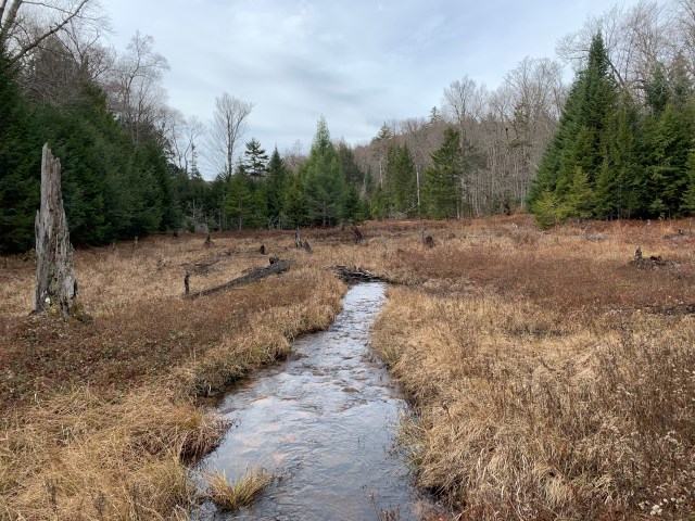
I parked once again at the trailhead for Chub Lake on Rt. 10 in Arietta NY. My plan was to follow the herd path over to the base of Chub Lake Mt. used by hikers and rock climbers, and drop down into the drainage once the herd path turned up the mountain. The drainage was an easy landmark to use with my bearing to Sherman Mt. From the drainage I would drop down a short hill, and then cross a tributary for Chub Lake, see below, another natural feature to help guide the way.
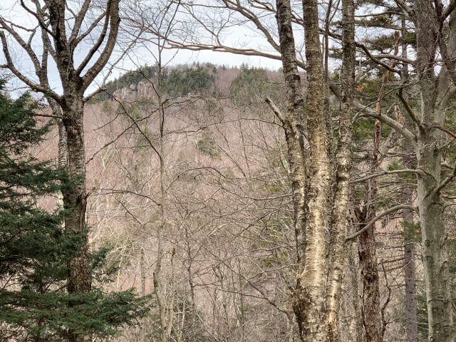
As I was nearing my exit from the drainage along the base of Chub Lake Mt., Sherman Mt. came into view. As I checked my bearing, and looked off in the distance, I located a stand of hemlock trees in the area that I had planned to climb to, before turning north to reach the summit.
Crossing the tributary between Chub Lake Mt. and Sherman Mt. was quick, and without wet feet! I took note of my exit and entry into the woods, and began to climb Sherman Mt. For the first two or three tenths the climb is gentle, and then the grade increases rapidly. The rock features of this mountain come into view quickly, and provide some nice climbing, or an obstacle to get around, if you do not feel like climbing at the moment.
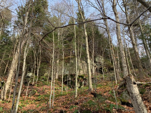
I arrived at the southern side, the lower side, of the summit exactly where I had planned. I then turned due north and made steady progress to the high point of the mountain. I explored around, descended on the north side to explore some rock formations, and then began to make my way back to my south side exit. While there is no lookout on the summit, there are plenty of breaks in the trees as you wander about to look at the surrounding wilderness.

The hike down and back to the trailhead was uneventful. I stopped and had a quick snack as I crossed the tributary once again, see below, up a short hill to the Chub Lake Mt. drainage, and then reconnected with the herd path back to my vehicle.

Now to Good Luck Cliffs.

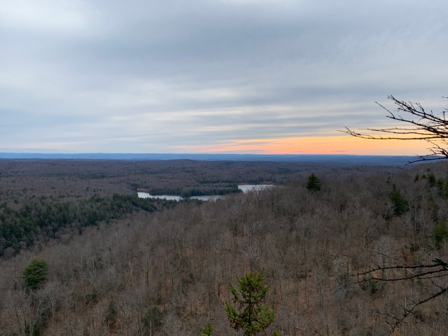
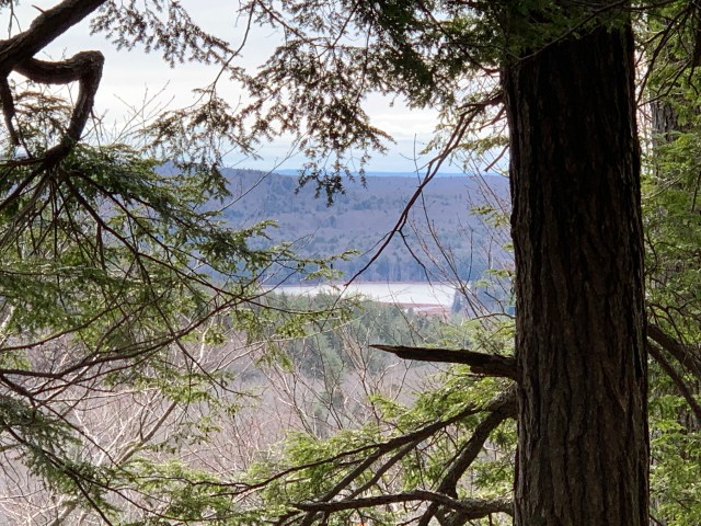
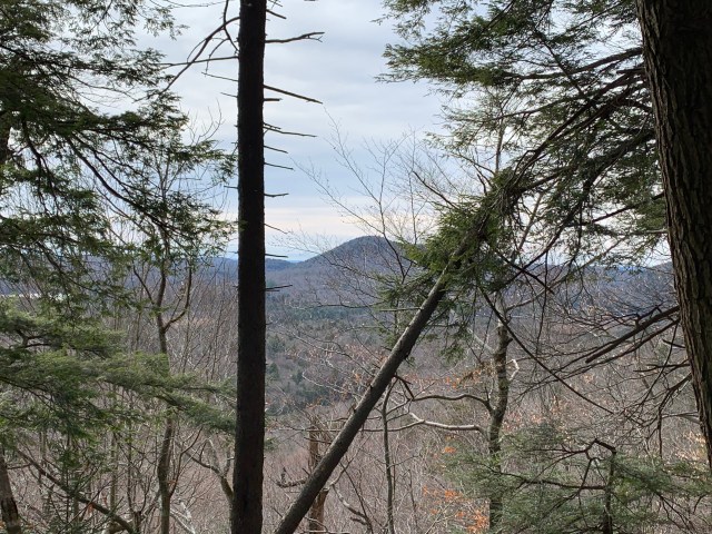
I have hiked the area around Good Luck Cliffs and Lake many times. Because it is so close to my house I will often drive over to trail run, just for something different to do. I had planned earlier in the day to climb up Good Luck Cliffs, descend down the north side, and then hike out to Dry Lake and Dexter Lake. It had been overcast and chilly all day so when I hit the summit I sat down for another snack and decided that I would descend and head home, saving the lakes for another adventure up a neighboring mountain I have yet to climb. As always, the view from the cliffs is excellent. An extra blessing is that I can see our home mountain off in the distance. Snack over. Now to the bushwhack.

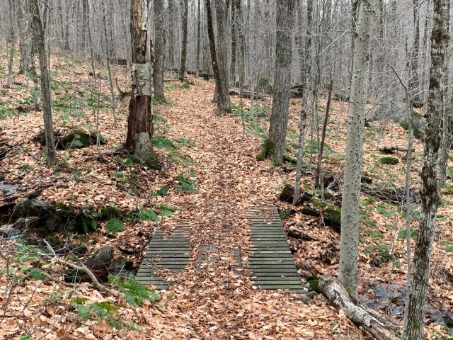
Earlier in the day I had taken the bearing to descend from a spot on the trail, just before the summit, that I knew well. This spot would provide a direct route down the mountain, and connect me to the Dexter Lake trail approximately .4 of a mile away. When I hit the trail, by the snowmobile bridge, I would turn right and hike .3 to the trail register before heading the .6 to the vehicle parking.
It was a quick descent. It is here, however, that I will remind you, and me, to always trust your compass – provided that you have used it properly with a map! As I am beginning my descent I look over to a mountain across the way – State Brook Mountain – and I’m thinking to myself, “I don’t think I have to go over that.” Being that I was still at elevation, more or less, the landscape was playing with my eyes. I looked at my compass again, and said, “I know I took the correct bearing, trust the compass.” Of course, as I dropped down, I could now see – and be reminded of what I had observed on the map – I was descending into the valley between the two mountains, just above State Brook. I landed on the Dexter Lake trail exactly where I had planned, even in spite of my earlier momentary hesitation.
While this was a much shorter bushwhack than Sherman Mt., it reinforced the importance of proper map and compass use, and application in the field. I walked back to civilization contemplating my trek that day. In my eight mile adventure I only saw one other person, and I was able to have some time of prayer and communion with the Lord. There is also something deeply satisfying about taking a map, finding a landmark or feature, noting that there is no trail, taking a bearing, and traveling there and back again safely with only a compass and map to lead the way. Hard to put into words, but deeply satisfying.
There is a need, on the level of the soul, for a person to go out into the wild places, and reconnect with something pure and natural. The trail, even when there appeared to be no trail, was right there before me. The compass told me where it was, even while I could not see it. It’s a lot like walking by faith, and not by sight.
Be well, Shalom, and happy hiking.
