Trails-less Traveled 4

View from a lookout on State Brook Mountain, looking toward Good Luck Mountain.

Destination: State Brook Mountain
ADK Location: Ferris Lake Wild Forest
Roundtrip Mileage: 7 miles
Elevation: 2550 ft.  
Elevation gain: 850 ft.

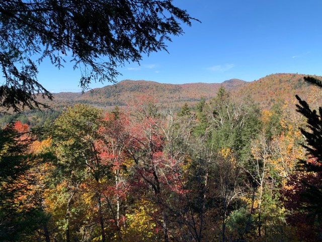
On my bushwhack down from Good Luck Cliffs on November 12, 2020, I took note of the mountain due north of my path. Since I had not hiked the Dexter Lake Trail, snowmobile trail S81, from the trail register leading to Good Luck Cliffs, I had never noticed this beautiful looking mountain. From the north shoulder of Good Luck Cliffs, State Brook Mountain looks huge, and imposing; for good reason, it is. While referred to as a “low peak,” it has its challenges, many dangers, along with its beauty.

Heading down the Dexter and Dry Lake Trail, snowmobile trail S81.

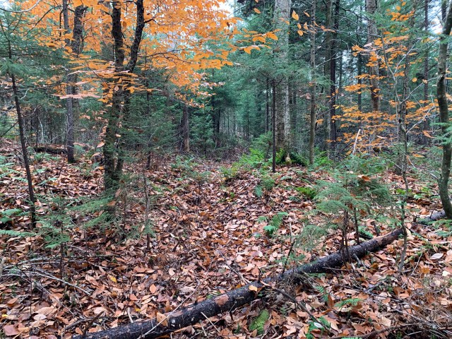
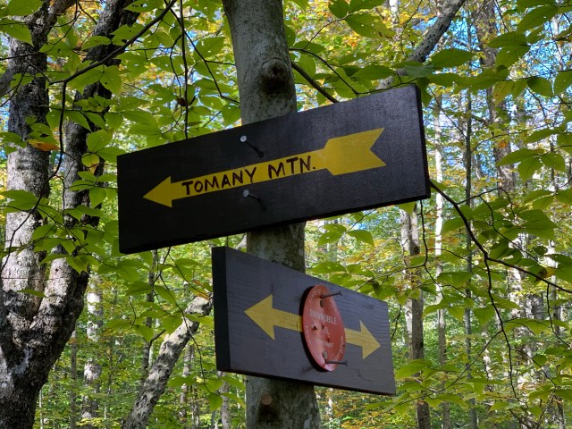
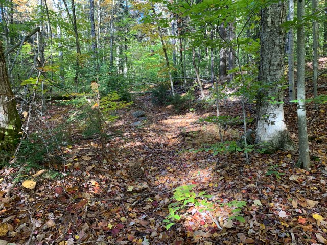
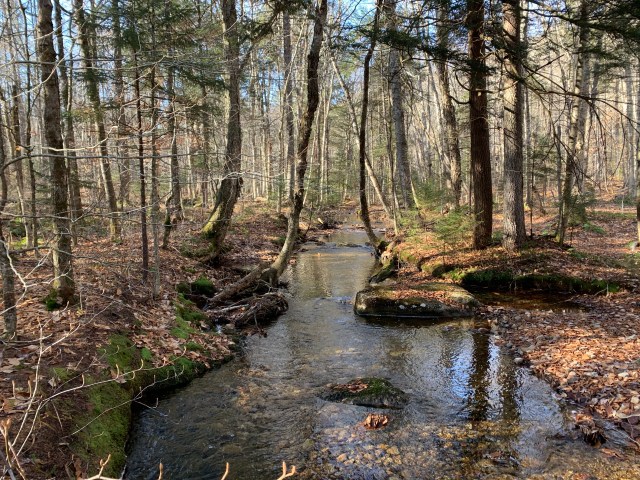
From the trail register, at the junction of the trails for Good Luck Cliffs and Dexter and Dry Lake trails, I turned west down the Dexter Trail, S81, to the bridge .3 of a mile down trail. This is the same bridge where I had ended my Good Luck Cliff bushwhack. The bridge would be the known landmark that I would use to plan the bushwhack up State Brook Mountain. From that location I would take a north westerly track, following my bearing, to the summit of the mountain.

Now on the bushwhack, heading down to State Brook, and beginning to get a view of State Brook Mountain.
Crossing State Brook.

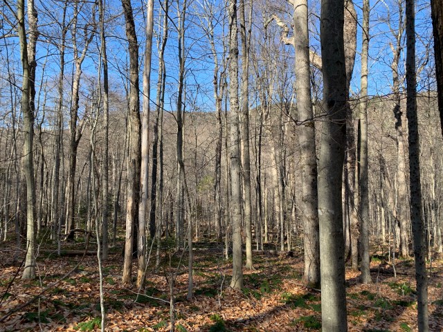
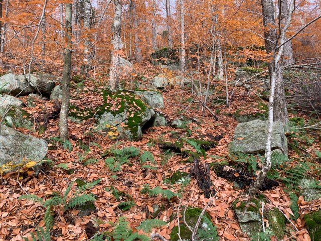
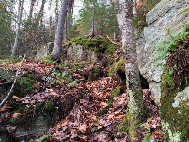
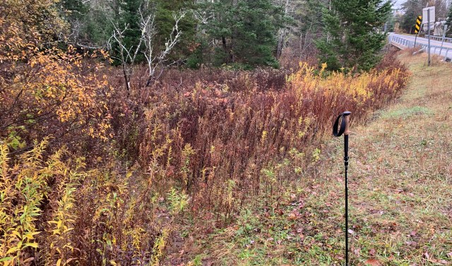
I had measured the bushwhack to the summit as .8 of a mile, as a straight shot; then I would descend heading due west for one mile to rejoin the trail. The mileage up, of course, did not account for avoidance of obstacles, and detours to see rock faces, etc. From both the map, and my visual observations while on the north shoulder of Good Luck Cliffs, I knew the ascent would have some steep sections, but what was obscured from view was the very prominent rock faces, ledges and outcroppings. The contour lines on the map indicated some very steeps sections, so I planned my trek to pass between them as much as possible.

A rock section at the base of the rock face above, behind the trees.

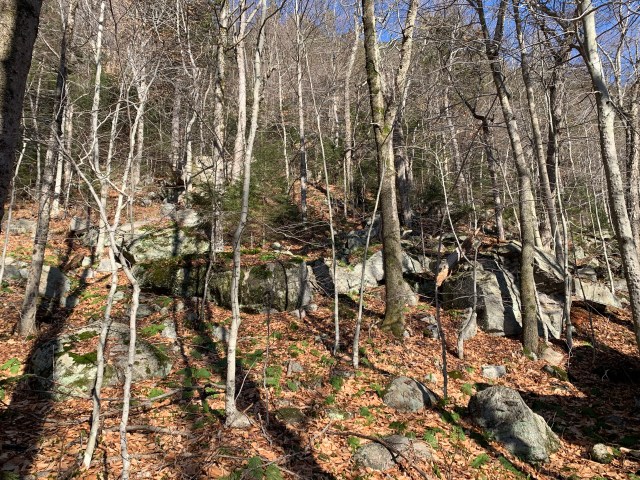
While not a popular hiking destination, State Brook Mountain is seeing more traffic from rock climbers. Several times I departed my planned path to take a look at some of the rock faces, and sections that would require rock climbing skills to ascend. While I did find a chimney that a hiker could climb up, on this day I was solo, so I opted to not take the risk. That being said, I can see why rock climbers like this little mountain.

One of several small waterfalls; not the best example, I uploaded the wrong picture.

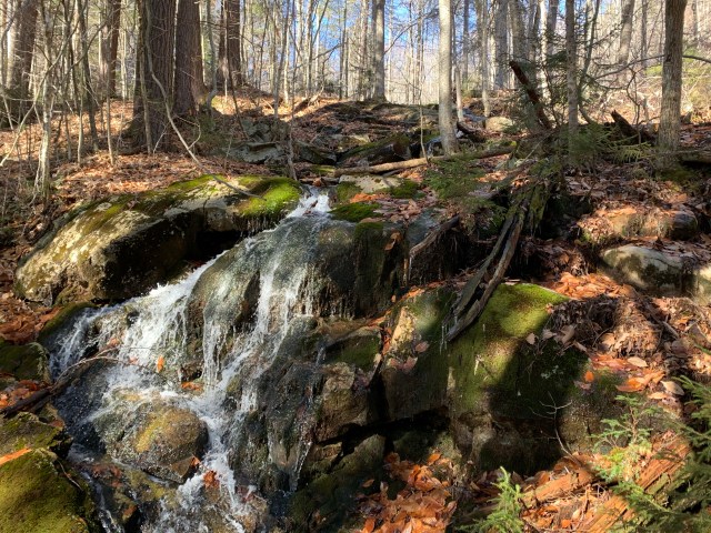
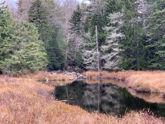
State Brook Mountain has some wonderful features to take in while hiking. Not only the impressive rock formations, but also a brook coming down a steep section creating several beautiful small waterfalls.

From a small lookout just off the summit of State Brook Mountain you can see the backside of Good Luck Cliffs, center of picture.

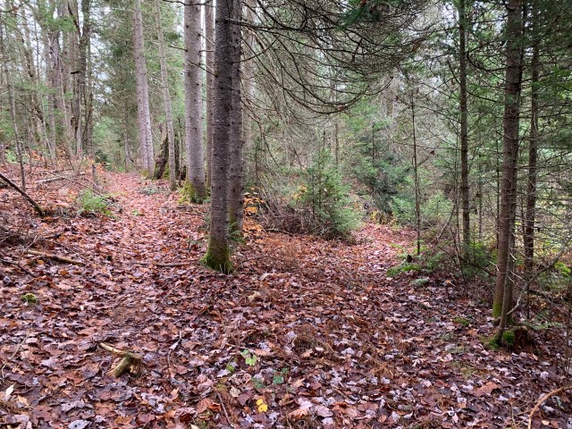
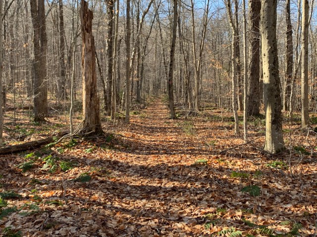
After doing some exploring, I headed up to the summit. It is a surprisingly steep mountain with nearly 850ft. of elevation gain, from State Brook to the summit of State Brook Mountain. The summit is wooded, with a boulder nearby, but otherwise just woods. I spent a few minutes looking around, and then decided to head to my next destination, Dry Lake. I reset my compass with my next bearing, and began to descend. Unfortunately, a slight navigational error – as I walked, not on the compass – put me on the cliffs that form the summit, with drops of 30′ or more feet in some spots. Rather than take the time to figure out how to get to the spot I originally intended, I hiked back to the summit, and back the way I came. This proved to be quicker. Once I began my descent, I got back on course to Dry Lake. This added a few tenths of a mile, but not at all concerning. About a mile later I was back on the Dexter Lake Trail, S81, about .5 from the bridge where I began my bushwhack, and about .5 from Dry Lake, exactly where I had planned to rejoin the trail.

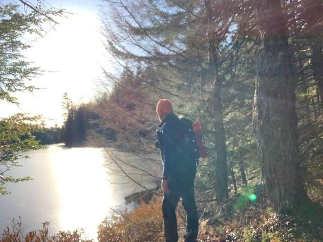
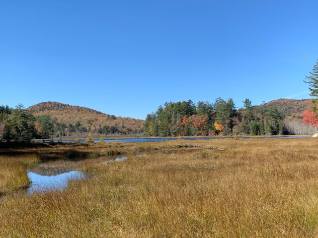
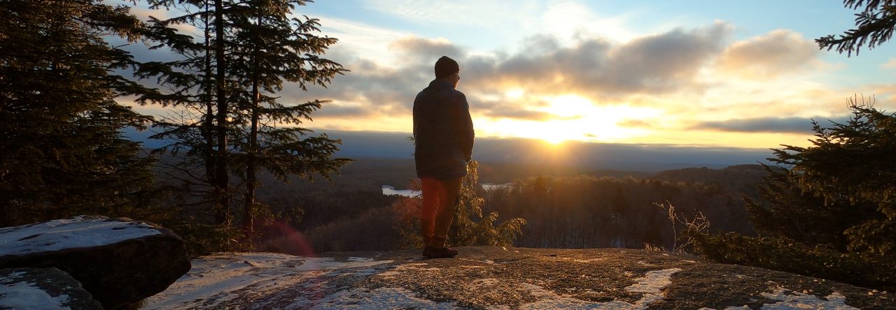
Dry Lake is a very nice spot. I sat by the frozen water, and had a drink and a snack for about 20 minutes before deciding to head back to the trailhead. There were a lot of things to think and pray about on this journey. It seems that day by day many of us are facing greater challenges. At times, it can seem that we are set adrift, rudderless, windless with no way to find safe harbor. Yet, during times like these that we walk by faith, and not by sight. Remembering that we are resting, even in the challenge, in the One who delivered our soul.

It is a hike like this one, on and off trail, wooded and open, that remind me that at times the way is obvious; while at other times, I have to trust in the power that I cannot see to lead the way – in orienteering terms, magnetic north. The Lord has given us the map, His Word, and He has placed in us the compass, the Holy Spirit, and with these two, no matter what lay before us, in Him we will reach the destination.

Be well, and happy hiking!

Trails-less Traveled 2

Along the West Branch Sacandaga River, outside of Arietta, New York, about 2.5 miles in.

Hike Date: October 23, 2020

Destination: North Branch Mountain
ADK Location: Silver Lake Wilderness
Roundtrip Mileage: 10 +/-
Elevation: 2738 ft.
Elevation gain: 888 ft.

As in my previous Trails-less Traveled post, this trailhead is one that I have passed frequently. After my visit to Chub Mountain, I decided to investigate other mountains nearby. As I examined my map I noted Sherman Mt., and North Branch Mountain. While there is a trail that leads in their general direction, neither of these mountains have trails to their summits. A perfect place to fine tune some bushwhacking skills. For those who don’t know, a bushwhack is a means of travel that uses map, compass, GPS, and natural landmarks to navigate to a destination where either there are no trails, or you desire to approach from a different direction.

My original plan was to head directly out to North Branch Mountain, which would require about 1.5 mile bushwhack from the end of the trail at the wetland to reach the summit.

I arrived at the trailhead a little later than expected, around 8:45am. I intended to make up the time delay, and move a bit faster while on trail. The first mile or so of the trail has numerous junctions and offshoots that are not indicated on the map, which shows only one junction. With my compass and map, and using my compass and landmarks, I was able to resolve directional issues rather quickly. Yet, I realized that I would probably only get North Branch Mountain on this day, and would have to leave Sherman for another time, as I had an afternoon appointment at my office before Friday evening Shabbat service. So, North Branch it was.

Two vital tools for any trek, trail or no.

I made steady progress to the terminus of the trail indicated on the map, just on the edge of a wetland area; this wetland area would be my baseline landmark for navigating out and back. When you reach the end of the trail, you can see the beginning of North Branch Mountain off in the distance. With the water level low I was able to keep to one side, and then turn into the woods and begin the bushwhack. With the bearing set on my compass, and seeing the faint tracks of another hiker from the day before, I was heading in the right direction. In about .4 of a mile I began my ascent up the steep side of the mountain.

Beginning the ascent up North Branch Mountain.

Fallen leaves, on top of wet rocks and mud, can be almost as bad as ice. It had been a rainy week, so the ground was wet. Steady progress up. The summit is wooded, as expected. This trek, however, was not about the views from a summit, but the bushwhack itself. Plotting a course, taking a bearing, identifying landmarks from the map in the field, and safely completing the bushwhack portion of the trek.

An interesting section of North Branch Mountain.

As I descended from the summit I decided to bend toward the draw and follow the drainage down. I knew that this would deliver me about 100 yards from where I began my ascent. Knowing that at the base I would turn right, now following a reverse azimuth, I would begin to listen for the sound of the river that would deliver me back to the wetland where I began my bushwhack.

This is the end of the trail on the map. It is the edge of a wetland, which is just ahead.
This is the view about 100 yards from the beginning of the wetland, you can see a shoulder of North Branch Mountain in the distance.

Dialing in map and compass skills, and identifying geographic features and sounds, noting positions, etc., is key to returning safely from a bushwhack. At one point on my way back, having forgotten that the drainage took me further east than I anticipated, I stopped, had a drink and said, “I think I’m lost.” No. Checking my compass, I was right on track. In fact, I was about 50 ft. from the break in the trees that would allow me to walk along the side of the wetland, the exact spot I passed through earlier. Trusting your tools, once you know how to use them, is vital.

A view along the semi-maintained trail.

The way out was relatively uneventful, but enjoyable nonetheless. This was the longest intended bushwhack I had done, about 3 miles total. I took my time heading out, stopping to admire the river, the beaver huts and dams, and have a snack or two.

Overall, an excellent, short hike in an area not heavily trafficked. I plan to visit again to snowshoe, and explore a little further into the wild.

State marker indicated a wilderness area at the trailhead parking area on Rt. 10 just over the bridge out of Arietta NY. You can enter here, and take the trail on the right to the river, but see below.
An easier trail to take is at the end of the trailhead parking area toward the bridge. My trekking pole is next to the break in the weeds that begins the footpath.
This is first break in the trail that I was not expecting. Here, you bear left.

Next time, Sherman Mountain.

Trails-less Traveled – 1

Chub Lake, Arietta, NY.

The trails-less traveled series will focus on trail-less, unmaintained, or lesser traveled trails, mountains, and destinations in the Adirondack Park.

Hike Date: October 9, 2020.

Tomany Mountain.

Trailhead parking on Rt. 10. Enter the trail across the road, about 10ft. from the guardrail, it is not marked, see below.
Entry point for the trail, it will be obvious as you get closer.

Location: Rt. 10, Hamilton County, NY.
ADK Location: Ferris Lake Wild Forest
Roundtrip milage: 3.9 +/-
Elevation: 2589ft.
Elevation gain: 1150ft.

I have driven by this trailhead parking area dozens of times, but never knew what trail originated there. Map out. Tomany Mt. The trail up Tomany Mt. has not been maintained officially since the late 1980’s, most likely ending with the decommissioning of the fire tower that once stood on top of this mountain. The tower was disassembled in 1987. The trail follows, roughly, a line of old telephone poles, with some very old DEC foot trail markers. While not maintained officially, some kind hiker(s) has marked the trail with orange, or orange and black, surveyors tape. At points you can lose these markers, or they have fallen off, specifically about .3 from the summit. The trail has some blowdown, but not too bad. As you follow the trail, which takes you slightly around the summit, you will end up by the foundation for the old observers cabin. See pics below.

Overall, it is an enjoyable hike. Nothing too strenuous, but as always, be prepared for entering the ADK backcountry.

Features

Observers cabin foundation, with steps.
A well-pump head laying on the ground.
The footings for the fire tower.
The disregarded remains of the fire tower.

While this is a short trail, being technically trail-less, it will require some bushwhacking skills, along with a map and compass to be safe. Do not overlook this gem of the southern Adirondacks. While there are limited views, apart from winter, it is a beautiful and historic place to visit.

An example of the surveyors tape, and telephone pole found along the trail.
About .5 in where the Tomany Mt. trail crosses the snowmobile trail.
Steps to the observers cabin.
One of the footers for the tower, located about 100ft. from the observers cabin foundation.
Another view of the fire tower footings.
The remains of the fire tower.
Old footpath marker.
Old footpath marker on one of the telephone poles.
Well-pump from the observers cabin.
A nicer section of the trail. The trail is easy to follow for most of the trek in.
Taking in the scenery, and reflecting on Tomany Mt. from the stairs of the observers cabin.

Chub Lake Mountain

Location: Arietta, Rt. 10, Hamilton County, NY.
ADK Location: Silver Lake Wilderness
Roundtrip milage: 2.1 +/-
Elevation: 2109ft.
Elevation gain: 500ft +/-.

Another trailhead parking area that I’ve wondered about for some time. Again to the map. Unlike Tomany Mt., Chub Lake Mt. has no trail, but three different trails leading to it. From where you park, it will seem obvious that you enter the woods directly off the parking area. At this entry point, there is a trail on the left that will take you to Chub Lake, about .2 of a mile. If, from your vehicle, you walk towards the woods just to the left of the guardrail, a trail begins there that will take you to a marked campsite, the other trail ends up in the campsite as well. Through the campsite you will head toward the lake, and then across a marshy area to the base of Chub Lake Mt. From this point it is a bushwhack to the summit. It is not a difficult climb, but, like any bushwhack, it will take a bit longer than expected as you navigate your way up and down. Please take a bearing to be safe, and have your map with you.

Features.

The features on Chub Lake Mt. are the rock walls used by rock climbers, and some nice rock outcroppings that you come across on the way up. There is no view from the summit, but a couple of nice lookouts as you walk around before heading down. It is a beautiful, and quiet area.

A view from the marshy area at the base of Chub Lake Mt.
A nice view from just above the cliffs of Chub Lake Mt, looking to Trout Lake Mt. if I recall correctly.
A view of Chub Lake Mt. from the roadside of Rt. 10 in Arietta, NY.

Overall, it is an enjoyable hike. Nothing too strenuous, but as always, be prepared for entering the ADK backcountry.

While neither of these trails will lure summit seekers looking for great views, if you enjoy hiking, bushwhacking, and historical locations, these two mountains are awesome. Route 10 is often overlooked, but it has some of the best hiking, camping, and kayaking points in the ADK.

Enjoy, and safe hiking!