Trails-less Traveled 2

Along the West Branch Sacandaga River, outside of Arietta, New York, about 2.5 miles in.

Hike Date: October 23, 2020

Destination: North Branch Mountain
ADK Location: Silver Lake Wilderness
Roundtrip Mileage: 10 +/-
Elevation: 2738 ft.
Elevation gain: 888 ft.

As in my previous Trails-less Traveled post, this trailhead is one that I have passed frequently. After my visit to Chub Mountain, I decided to investigate other mountains nearby. As I examined my map I noted Sherman Mt., and North Branch Mountain. While there is a trail that leads in their general direction, neither of these mountains have trails to their summits. A perfect place to fine tune some bushwhacking skills. For those who don’t know, a bushwhack is a means of travel that uses map, compass, GPS, and natural landmarks to navigate to a destination where either there are no trails, or you desire to approach from a different direction.

My original plan was to head directly out to North Branch Mountain, which would require about 1.5 mile bushwhack from the end of the trail at the wetland to reach the summit.

I arrived at the trailhead a little later than expected, around 8:45am. I intended to make up the time delay, and move a bit faster while on trail. The first mile or so of the trail has numerous junctions and offshoots that are not indicated on the map, which shows only one junction. With my compass and map, and using my compass and landmarks, I was able to resolve directional issues rather quickly. Yet, I realized that I would probably only get North Branch Mountain on this day, and would have to leave Sherman for another time, as I had an afternoon appointment at my office before Friday evening Shabbat service. So, North Branch it was.

Two vital tools for any trek, trail or no.

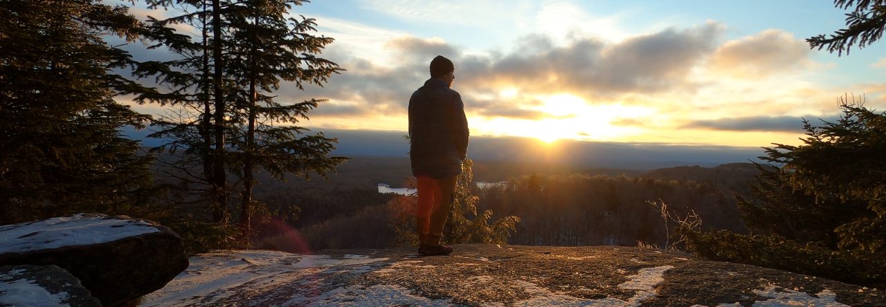
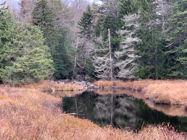
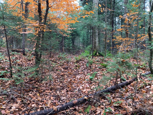
I made steady progress to the terminus of the trail indicated on the map, just on the edge of a wetland area; this wetland area would be my baseline landmark for navigating out and back. When you reach the end of the trail, you can see the beginning of North Branch Mountain off in the distance. With the water level low I was able to keep to one side, and then turn into the woods and begin the bushwhack. With the bearing set on my compass, and seeing the faint tracks of another hiker from the day before, I was heading in the right direction. In about .4 of a mile I began my ascent up the steep side of the mountain.

Beginning the ascent up North Branch Mountain.

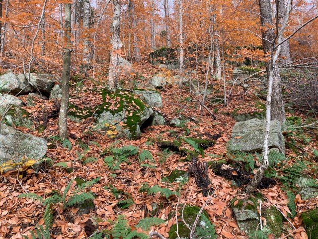
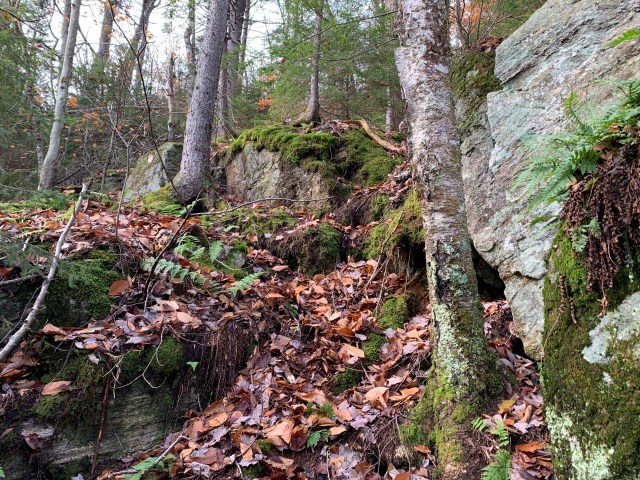
Fallen leaves, on top of wet rocks and mud, can be almost as bad as ice. It had been a rainy week, so the ground was wet. Steady progress up. The summit is wooded, as expected. This trek, however, was not about the views from a summit, but the bushwhack itself. Plotting a course, taking a bearing, identifying landmarks from the map in the field, and safely completing the bushwhack portion of the trek.

An interesting section of North Branch Mountain.

As I descended from the summit I decided to bend toward the draw and follow the drainage down. I knew that this would deliver me about 100 yards from where I began my ascent. Knowing that at the base I would turn right, now following a reverse azimuth, I would begin to listen for the sound of the river that would deliver me back to the wetland where I began my bushwhack.

This is the end of the trail on the map. It is the edge of a wetland, which is just ahead.
This is the view about 100 yards from the beginning of the wetland, you can see a shoulder of North Branch Mountain in the distance.

Dialing in map and compass skills, and identifying geographic features and sounds, noting positions, etc., is key to returning safely from a bushwhack. At one point on my way back, having forgotten that the drainage took me further east than I anticipated, I stopped, had a drink and said, “I think I’m lost.” No. Checking my compass, I was right on track. In fact, I was about 50 ft. from the break in the trees that would allow me to walk along the side of the wetland, the exact spot I passed through earlier. Trusting your tools, once you know how to use them, is vital.

A view along the semi-maintained trail.

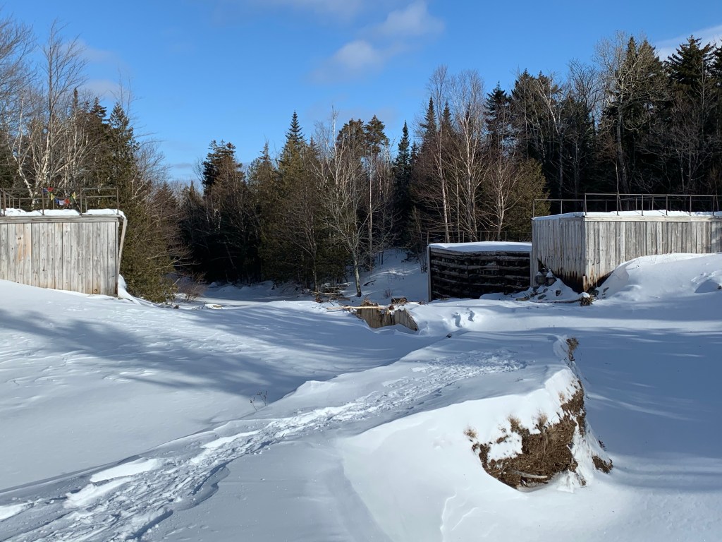
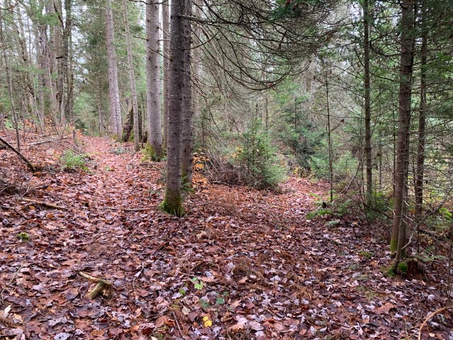
The way out was relatively uneventful, but enjoyable nonetheless. This was the longest intended bushwhack I had done, about 3 miles total. I took my time heading out, stopping to admire the river, the beaver huts and dams, and have a snack or two.

Overall, an excellent, short hike in an area not heavily trafficked. I plan to visit again to snowshoe, and explore a little further into the wild.

State marker indicated a wilderness area at the trailhead parking area on Rt. 10 just over the bridge out of Arietta NY. You can enter here, and take the trail on the right to the river, but see below.
An easier trail to take is at the end of the trailhead parking area toward the bridge. My trekking pole is next to the break in the weeds that begins the footpath.
This is first break in the trail that I was not expecting. Here, you bear left.

Next time, Sherman Mountain.

Phelps and Tabletop ADK Trip Report

View of Mt. Colden from Phelps.

After a couple of long and stressful weeks, I took some time on Friday February 21, 2020 to hike Phelps and Tabletop mountains in the Adirondack High Peaks. These are two excellent hikes, often overlooked because of their bigger neighbors, Mt. Marcy and Algonquin.

The temperatures on the way up were all over the place, from the lowest of -20F to about 10F at the trailhead of Cascade on Rt 73 just outside of Keene NY. At the Adirondack Loj parking lot it was 0F when I arrived at 8:00am.

Remnants of Marcy Dam.

Leaving the Loj, the turn off for Phelps is about 3 miles out. From there it’s one mile to the top. It’s a long Adirondack mile for sure, but much easier in the winter as compared to the summer.

On Phelps with Mt. Haystack in the background.

I had the summit of Phelps to myself, always a nice time. There was very little wind, so even though it was cold, it was comfortable. Marcy and Algonquin were still socked in the clouds, but they are still breathtaking, especially with the surrounding high peaks in view.

A flat section of the trail. They were all in wonderful condition.

I was still undecided as to whether or not I wanted to do Tabletop as I headed down Phelps. The trip down Phelps was quick, and with some buttslidding, a good time. After a short break I decided that Tabletop was too close to pass up. Off I went.

Signs along the way.

The herd path turn off for Tabletop is about a mile from the Phelps turnoff. As this is the Van Ho trail to Marcy, there is a solid amount of elevation gain in that mile. Tabletop does not have a marked or maintained trail, it’s a herd path – just follow where everyone else has walked. It’s about .7 up to the summit. During the summer you are walking in a stream bed, with lots of mud at elevation. There are some fantastic views once you get above the tree line, and a great view of Marcy, and the Great Range from the summit.

Summit sign for Tabletop.

I didn’t spend much time on the summit, as it was crowded and there was a cold wind blowing. It is such a nice peak, and nothing technical to deal with in any season.

Just off the summit of Tabletop with the MacIntyre Range behind me.

It was a bit of a long day, but beautiful. I had some nice conversations on the trails, and enjoyed some people skiing the Angel slide on Wright Peak. Also some guys from Germany skied down from Marcy, and flew into Marcy Dam…glad I wasn’t in their way on the trail.

Mentally I was in good spirits, but this trek physically stressed me for some reason. Maybe the cold? Not enough sleep? Not eating enough on trail? It could be anything. This is one of the amazing aspects of hiking, you can do the same hike you have done before, and have a completely different experience. While it wasn’t bad, and I, thankfully, wasn’t injured, I was super happy to open the Jeep, get out of my snowshoes, and head home.

Almost back to the Loj. If you zoom in you can see part of the peak of Phelps.

Trip log:

14 miles, 3000ft of elevation gain, about 7.5 hours on the trail. Excellent day!

2023 Summer Hike